About the Project
Mappa Anatolicorum is a digital humanities project that aims to reconstruct and visualize the lives of ordinary people and the relationships between settlements and primary sources in Anatolia between 1200 and 1450. The project's database is fundamentally built upon two core components: ordinary individuals and primary sources.
The project has been limited to contemporary Anatolian lands of the Türkiye Republic and primary sources have been selected between 1200-1450. By data mining from the 80+ primary sources, a database has been created and through GIS and SNA the data has been visualized, including settlements, ordinary people and the primary sources of the era.
Ordinary People
Comprehensive database of ordinary people from Late Medieval Anatolia
Following Ordinary People
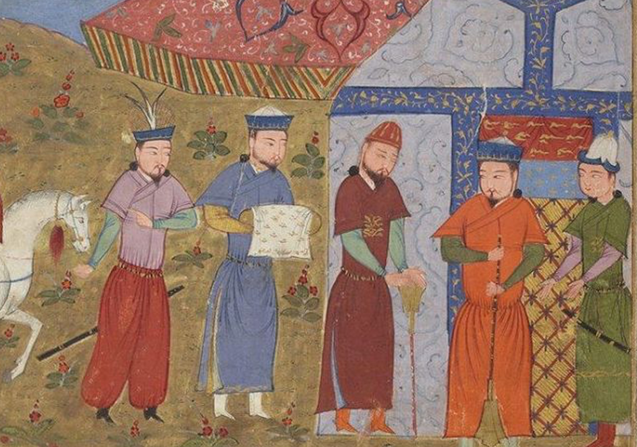
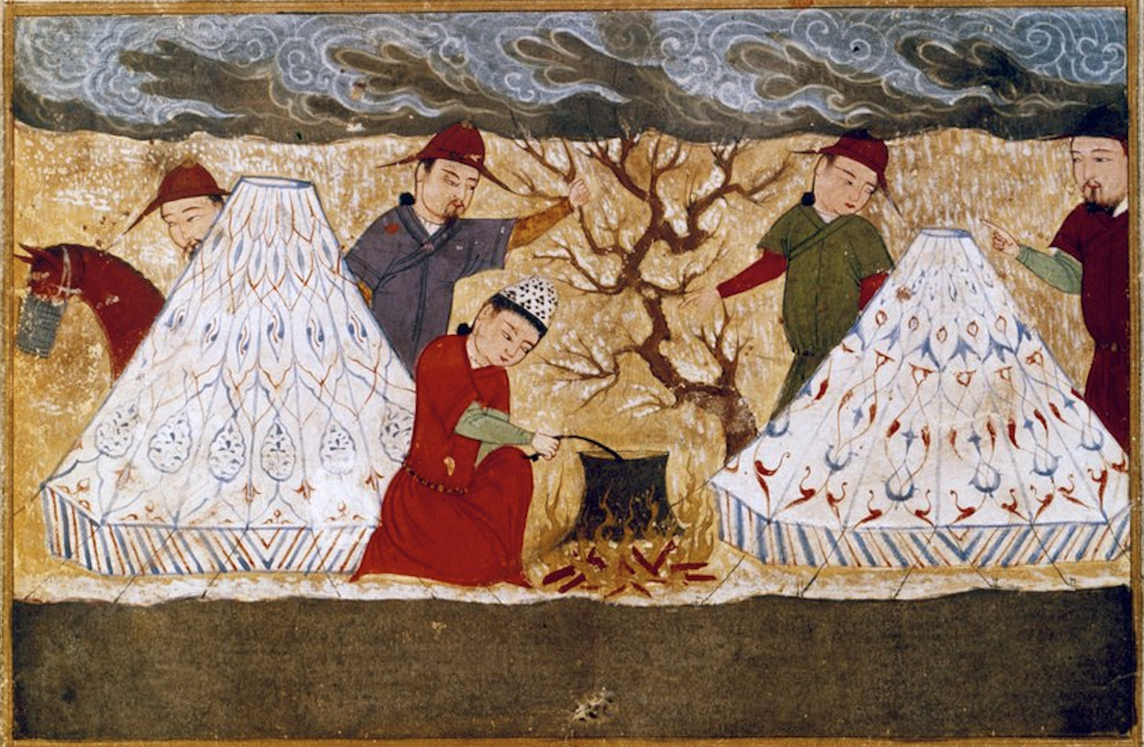
The first and perhaps most striking goal of the project is to bring to light the stories of ordinary people who lived in the Anatolian geography and had very diverse social and economic backgrounds, and to clearly reveal the complex social, cultural and economic relationships between these individuals.
The concept of 'ordinary person' addressed in this project encompasses not only individuals from lower socio-economic classes, but also a wide range that includes the anonymous heroes of daily life of the period, which traditional historiography generally neglects.
With the information obtained from the rich sources examined, a comprehensive database containing approximately 1000 different characters, from peasants to merchants, from soldiers to slaves, who may not have been considered very important under the conditions of that period and did not play leading roles in major historical events, but are vital for us to vividly imagine the ordinary daily life in Medieval Anatolia, has been created.
Database Examples for the Ordinary People
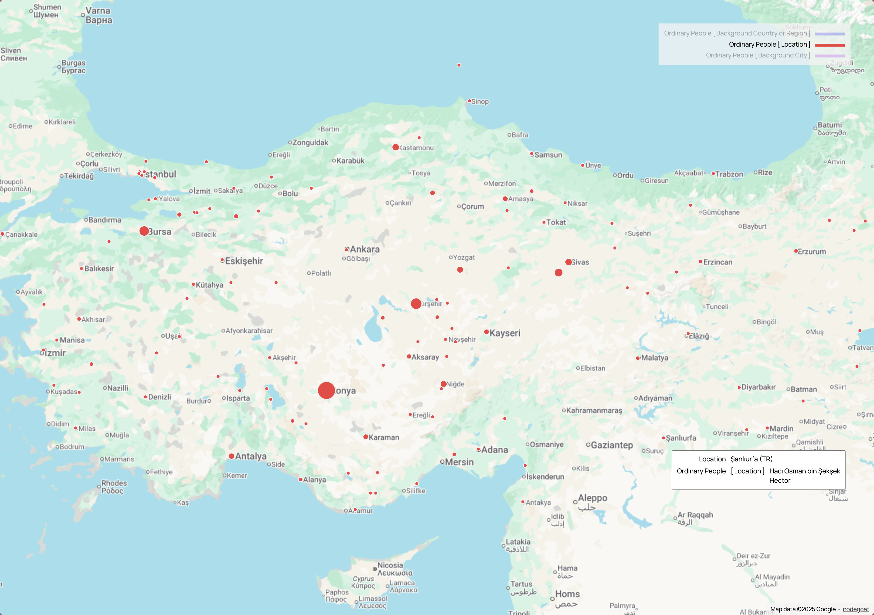
Map of historical cities and locations in Anatolian geography
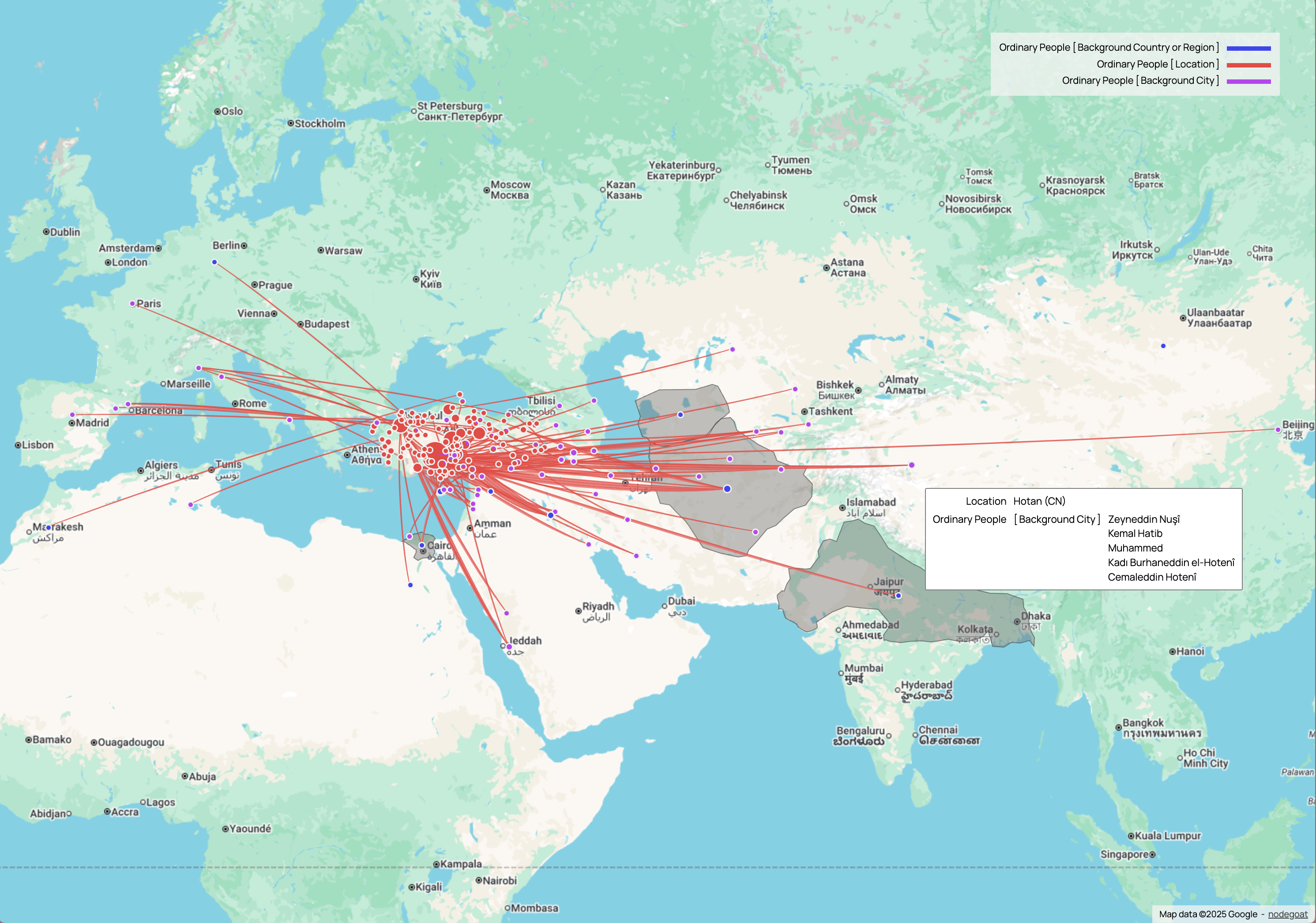
Historical connections extending from Anatolia to Europe, Asia and Africa
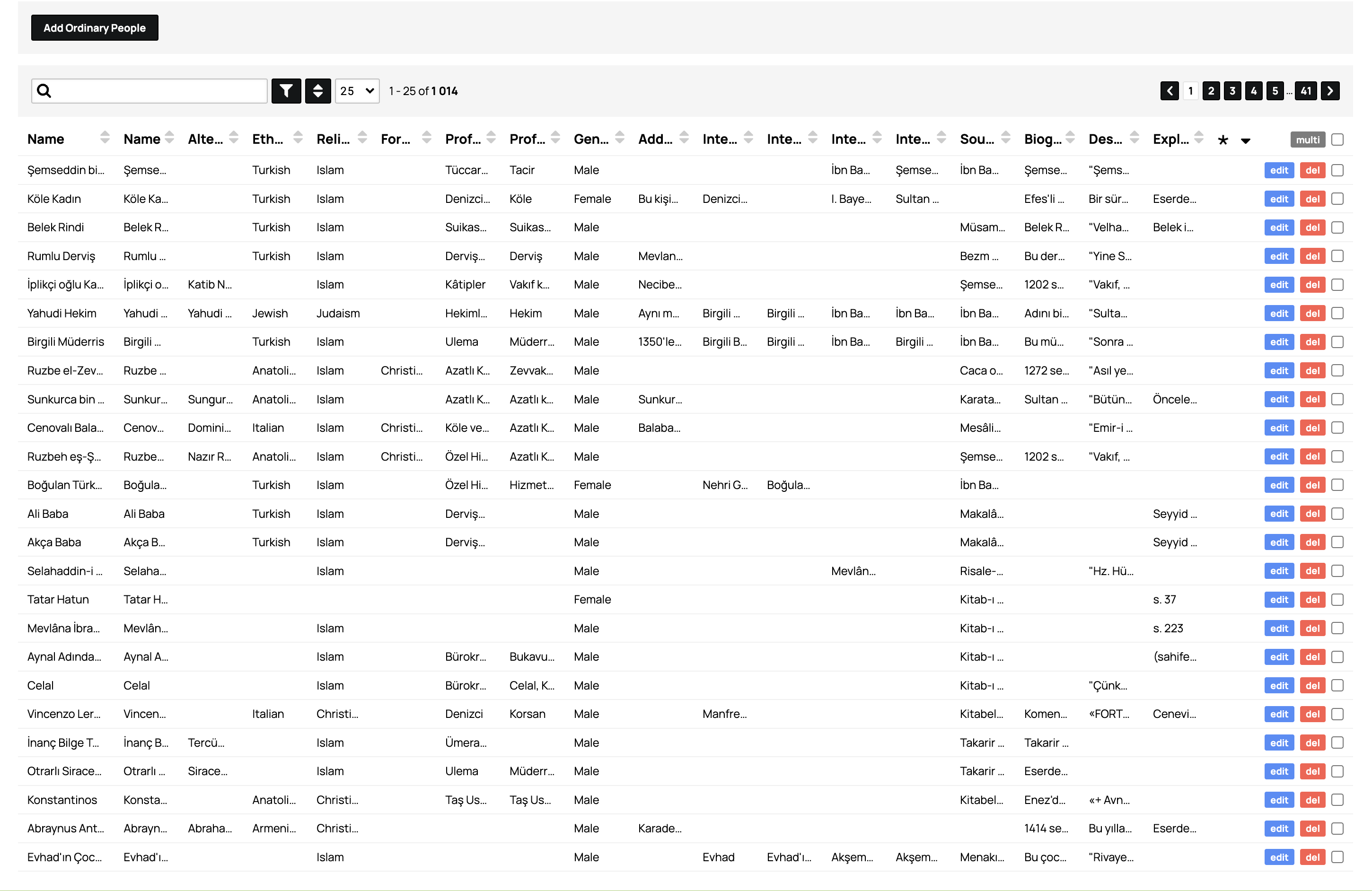
Database interface containing detailed information of historical persons
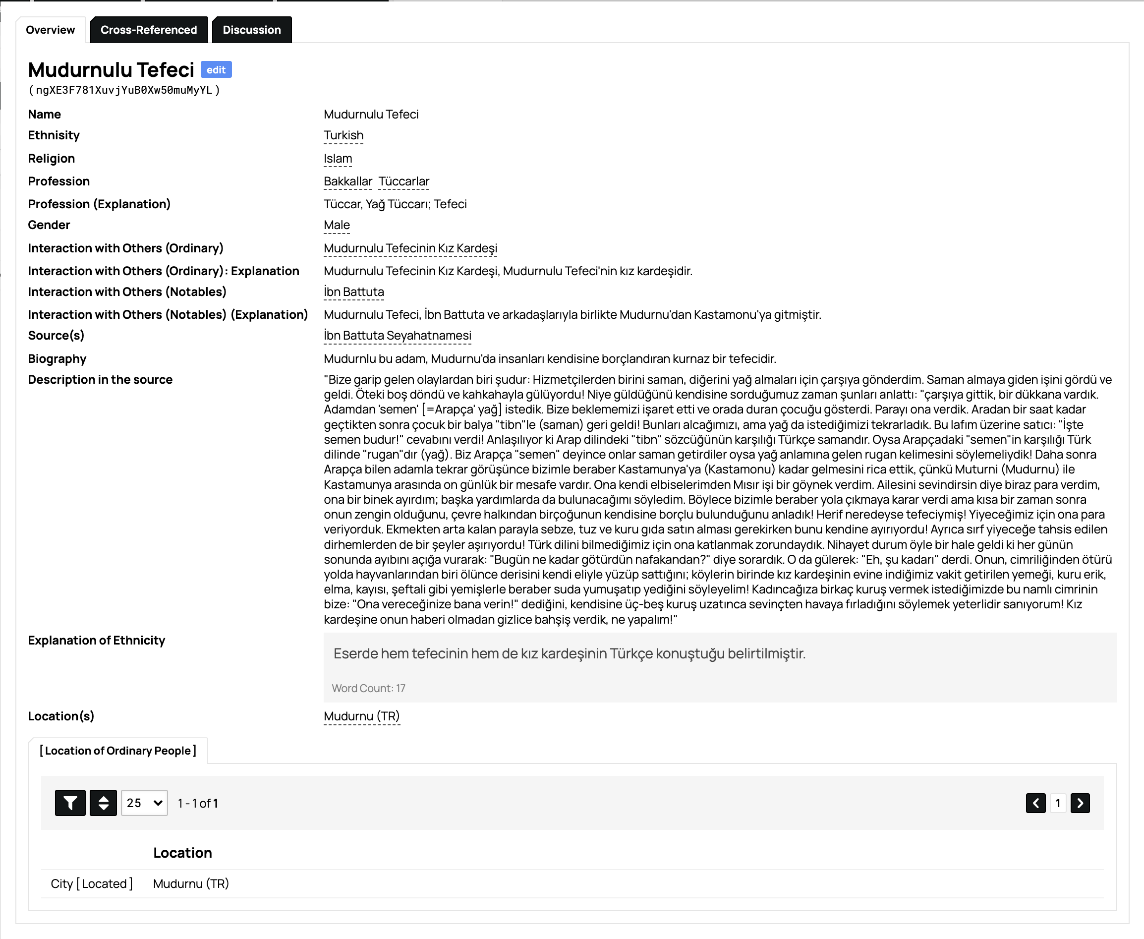
Example of a detailed profile page of a historical person (Mudurnlu Tefeci)
~1000 Characters
Comprehensive profiles of ordinary people from medieval Anatolia
Detailed Classification
Systematically organized and categorized data
GIS Integration
Geographically mapped using GIS technology
Primary Source Mining
Comprehensive bibliography and analysis of medieval Anatolian sources
Sources and In-Depth Bibliography
Mappa Anatolicorum consists of a meticulously prepared, in-depth bibliographic presentation of the primary sources examined.
Within the scope of the project, not only basic information about more than 80 written sources has been provided, but also comprehensive data on the detailed manuscript information of these valuable works and the libraries where they are located have been carefully collected and systematically brought together as much as possible.
This bibliography is aimed to significantly help researchers who want to conduct academic studies on Medieval Anatolia to reach the right source they need in a practical and fast way.
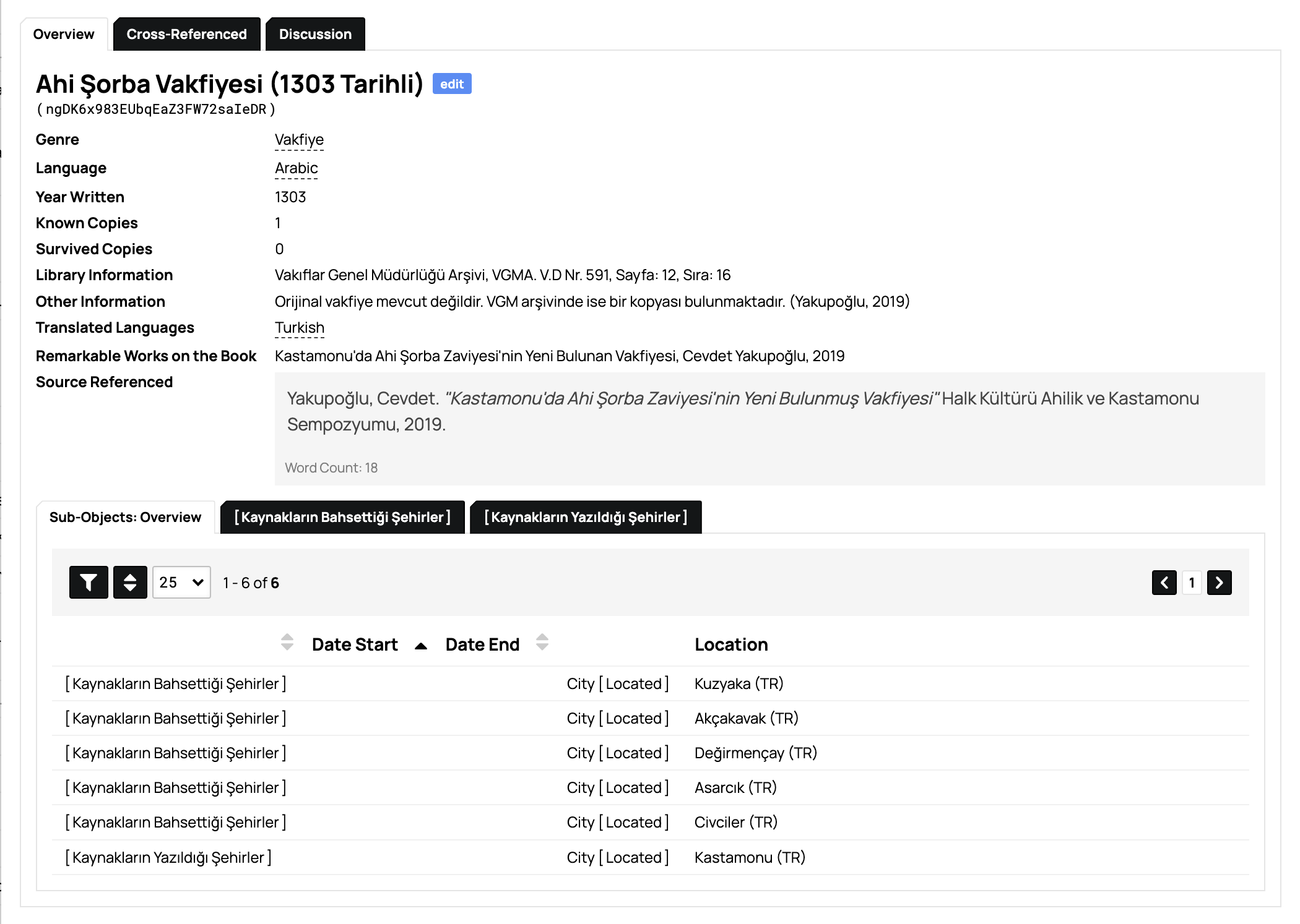
Ahi Şorba Vakfiyesi Database Entry

Geographic Database Interface
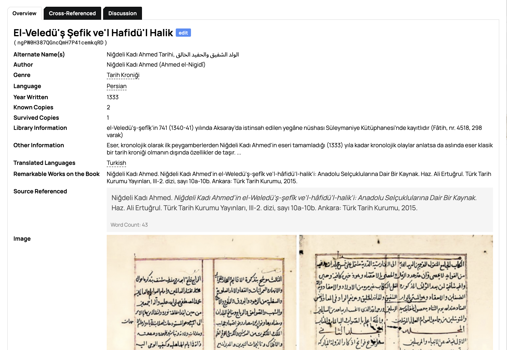
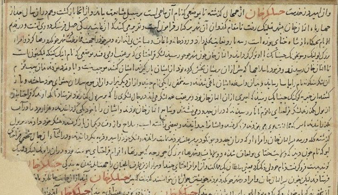
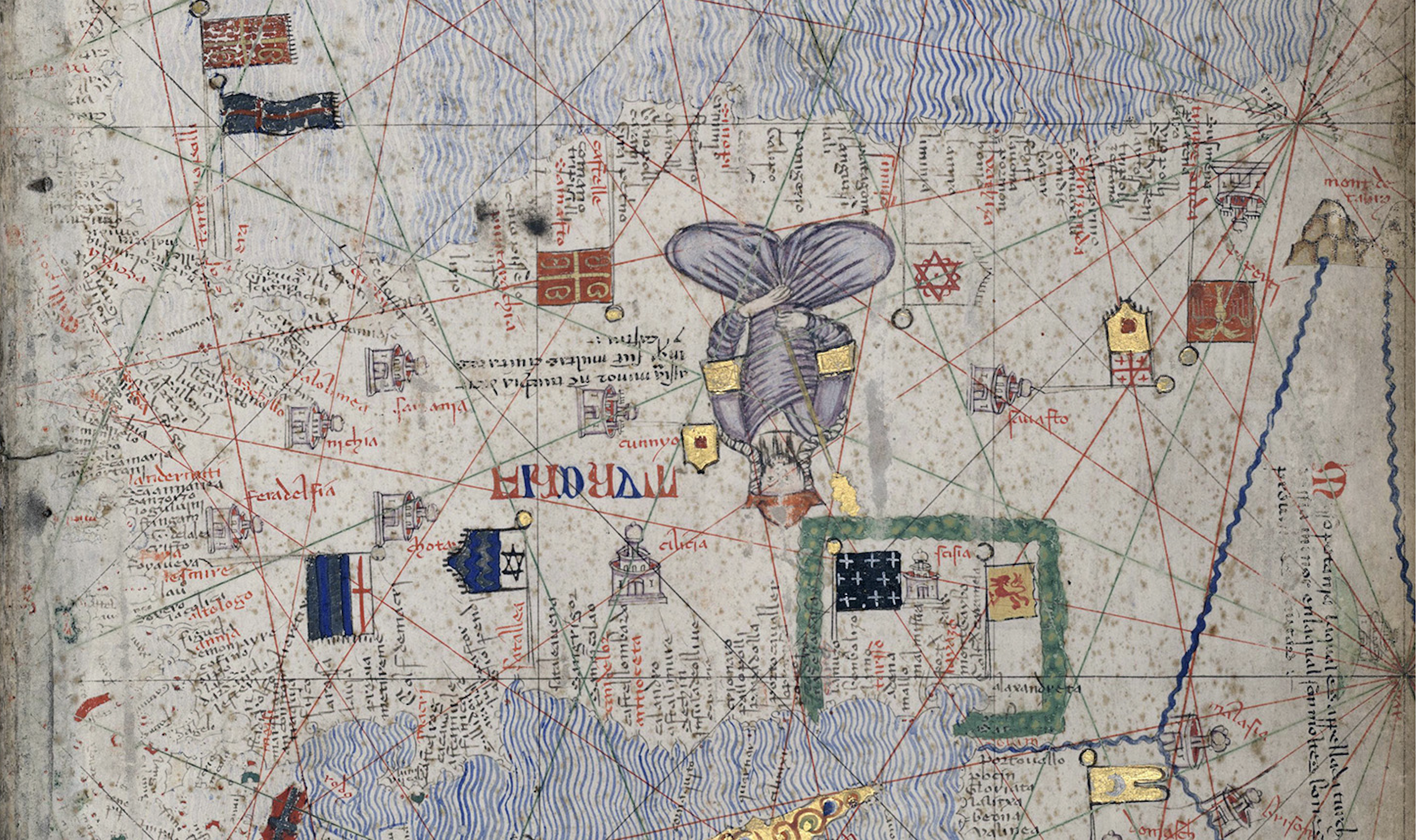
Persian Manuscript with Original Text
80+ Sources
Comprehensive collection of written sources from medieval Anatolia
Detailed Manuscripts
Complete manuscript information and library locations
Academic Access
Quick and practical access for researchers
Social Network Analysis
Analyzing relationships between ordinary people in medieval Anatolia
Relationship Networks and Social Connections
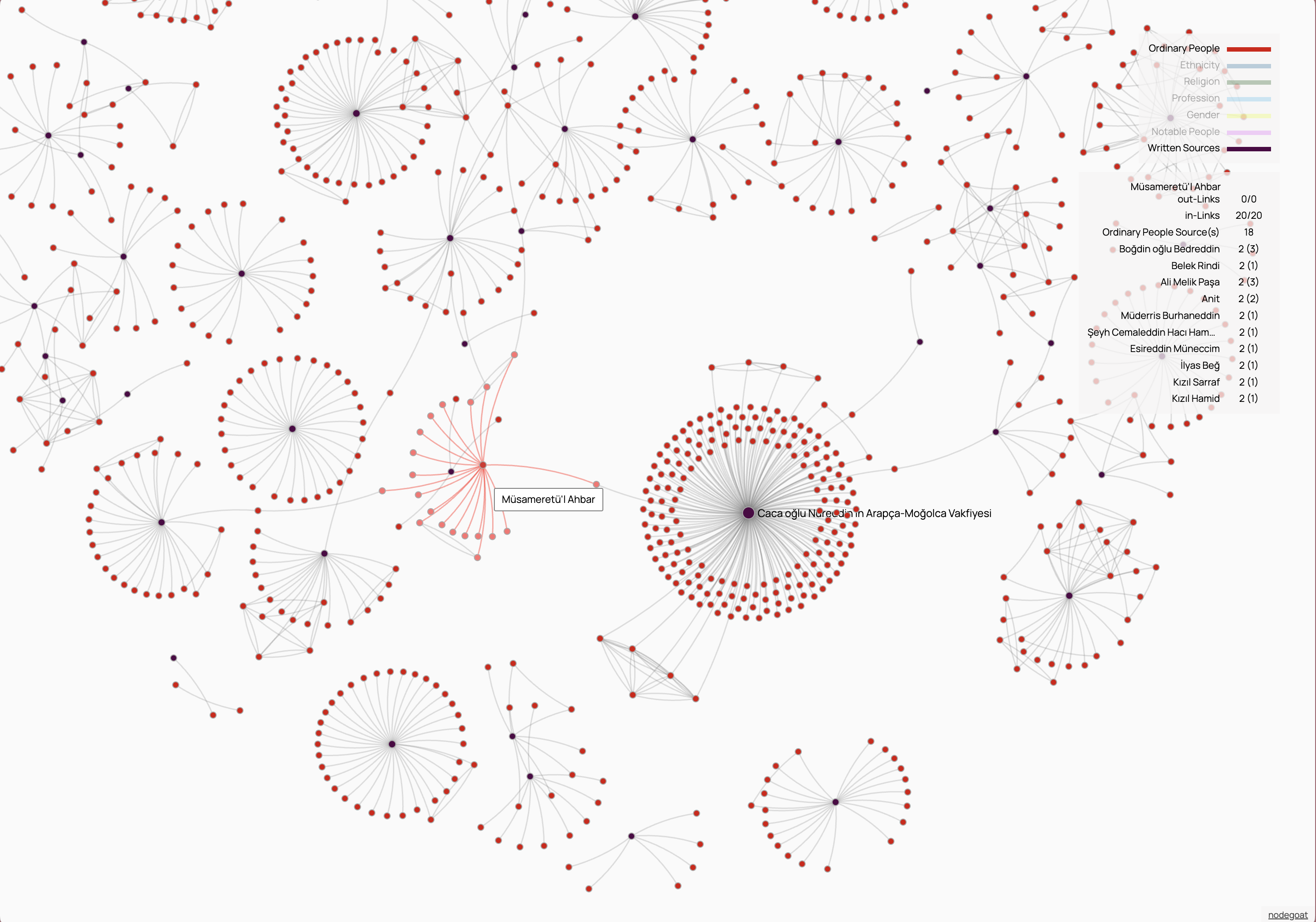
Moreover, using the Social Network Analysis (SNA) method, the interesting relationship networks that these 'ordinary' people established with the leading figures of the period and among themselves have been visualized, making it easier to understand the networks between different classification categories.
Thanks to this analysis method, social, cultural and economic connections that are generally overlooked in traditional historiography have been revealed and the complex structure of Medieval Anatolian society has been made more understandable.
Social Network Analysis Examples
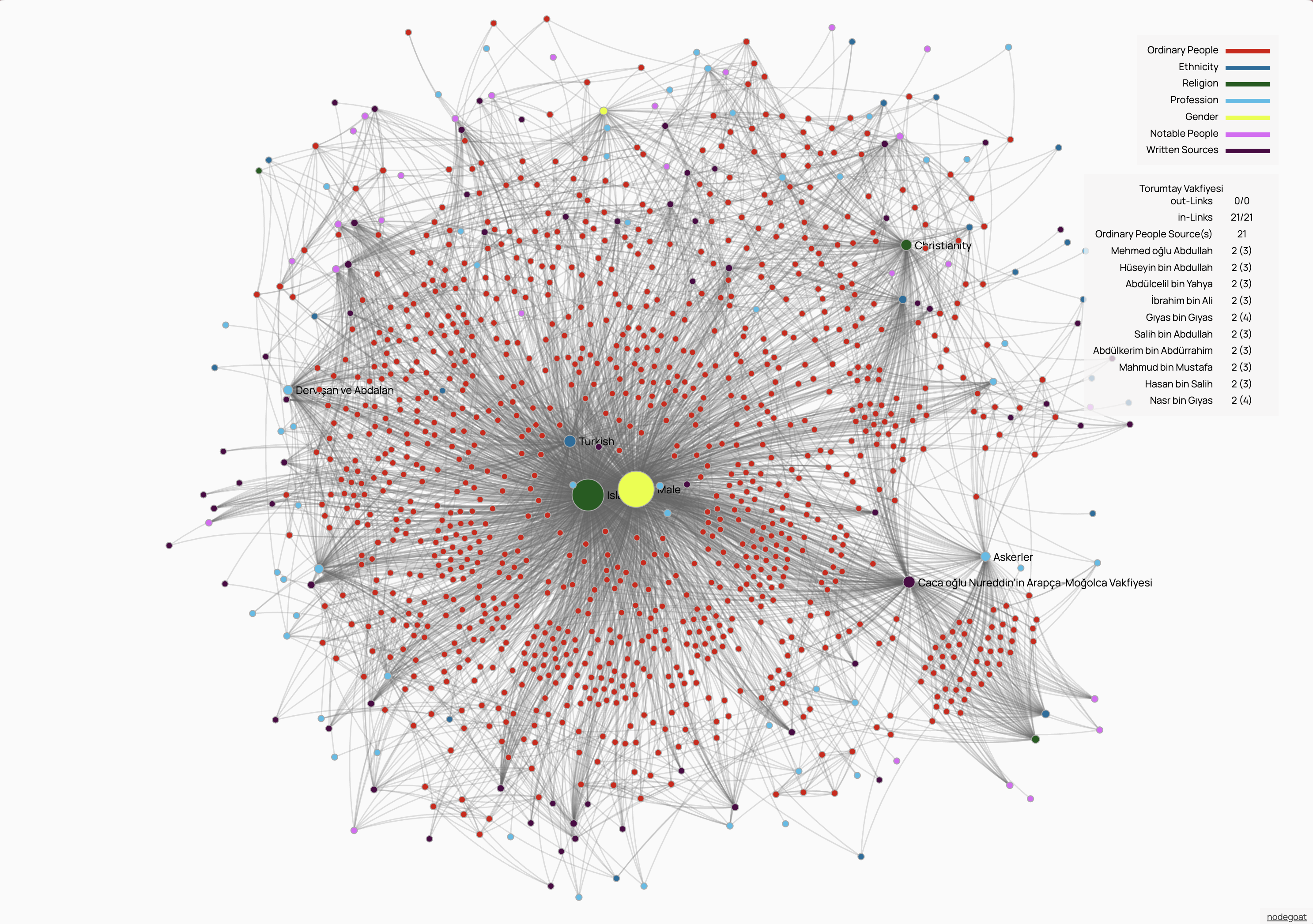
Complex Network Overview — Comprehensive network showing relationships between ordinary people, ethnicity, religion, profession, and notable figures with central hub structure
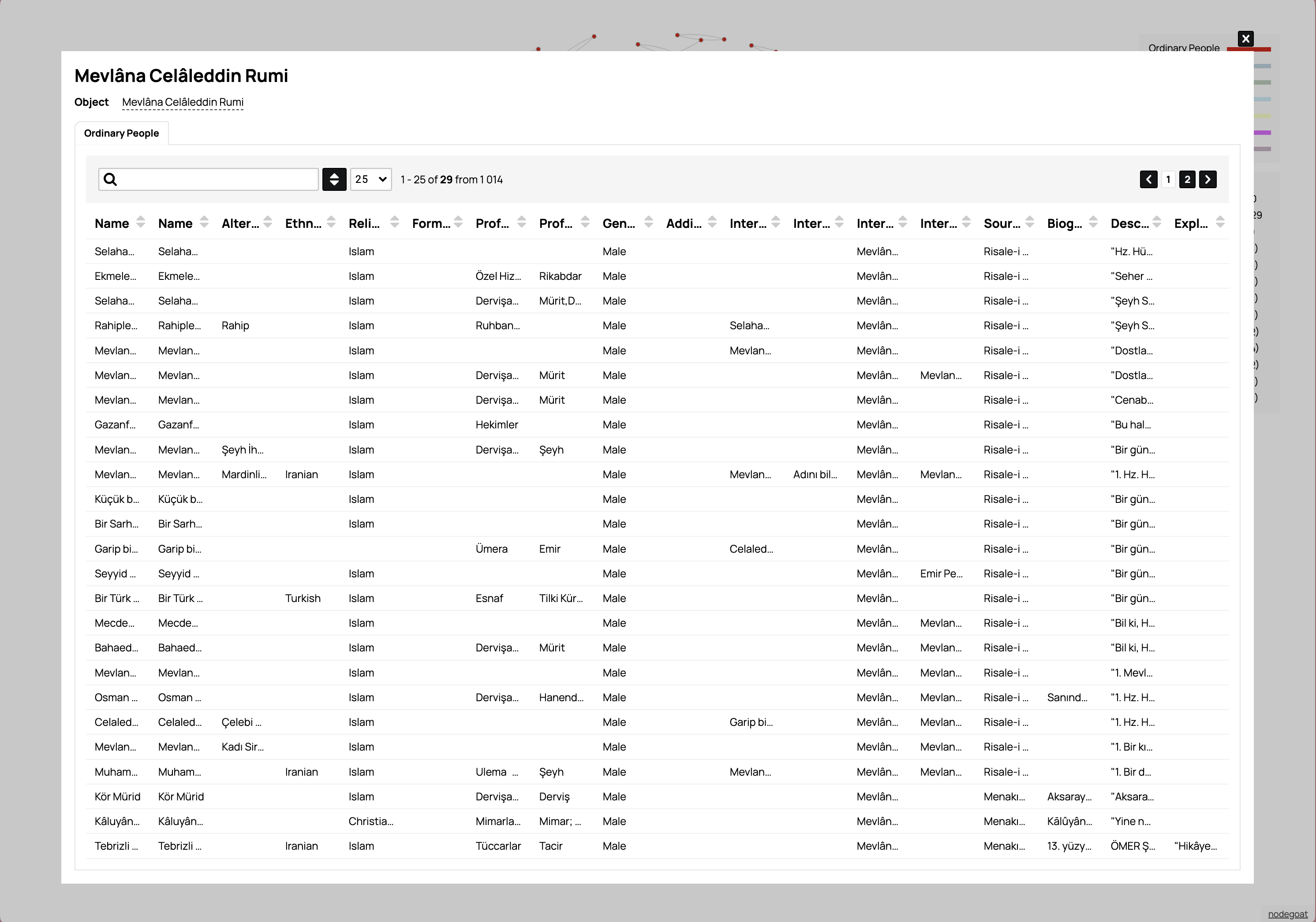
Mevlâna Celâleddin Rumi Database — Detailed database interface showing individuals connected to Rumi with biographical information and relationship data
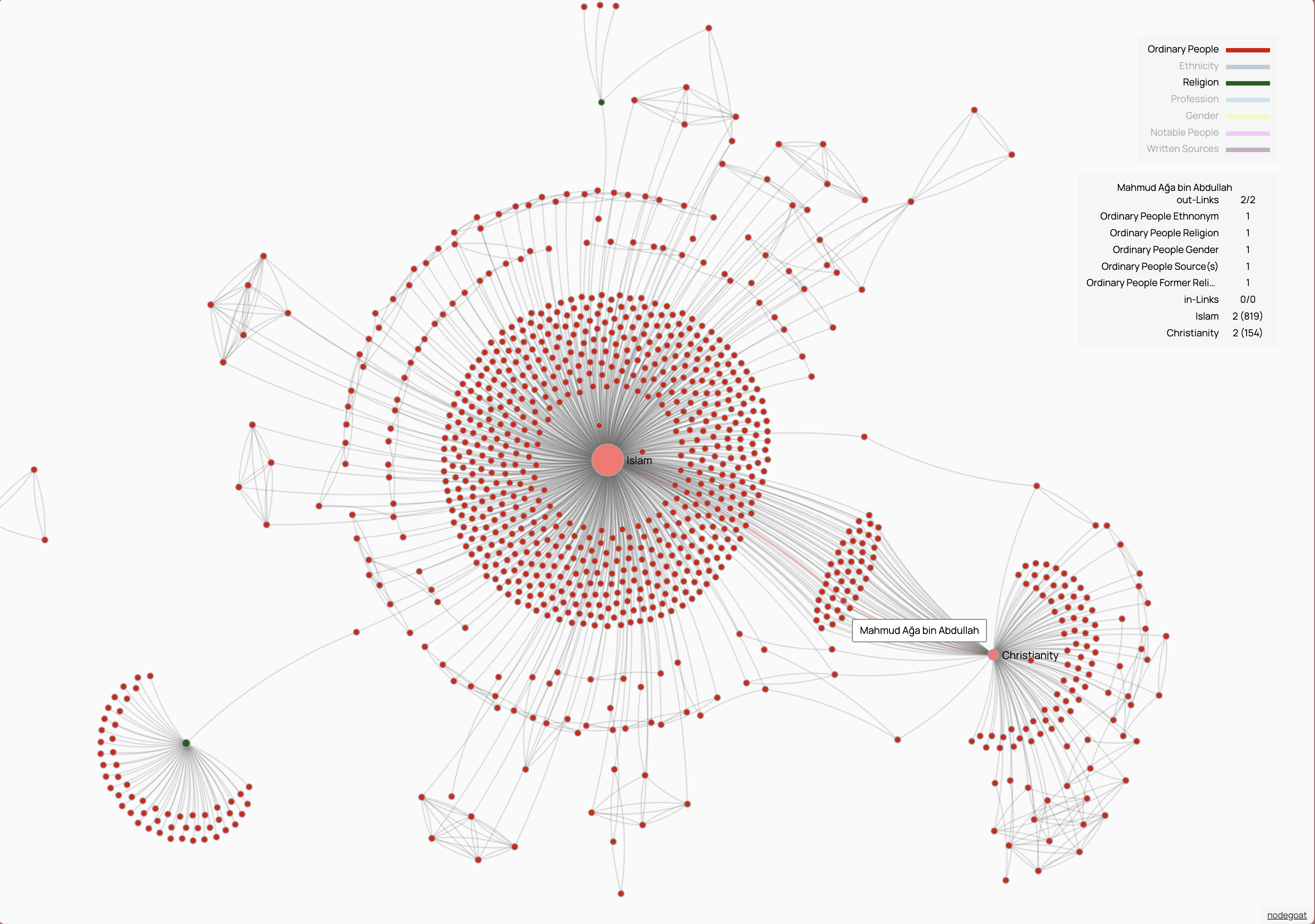
Religious Network Connections — Network analysis highlighting connections between Islam and Christianity with detailed statistics and relationship metrics
Manuscript Network Analysis — Multi-cluster network visualization showing connections between historical figures and manuscripts with detailed network statistics
Social Connections
Mapping relationships between ordinary people and prominent figures
Network Visualization
Interactive graphs showing complex relationship networks
SNA Methodology
Advanced Social Network Analysis techniques
GIS Mapping
Interactive geographical mapping of medieval Anatolian settlements
Anatolia's Toponymy Atlas
Another vital element of the project is the systematic mapping of settlements from the period.
Mappa Anatolicorum has created a unique Anatolian toponymy map covering the mentioned 1200-1450 time period by collecting the valuable data scattered in primary sources about settlements in the Anatolian geography under a single roof.
Thanks to this innovative map, researchers will be able to quickly and effectively identify the centers where important works were produced in Medieval Anatolia and the settlements most frequently referenced in these works, thus saving significant time in their valuable research processes.
This detailed toponymy map created is also a pioneering work in its field in terms of collecting very small settlement units such as villages and districts in a single map. Thanks to the unique data it provides for a period that extends even before the early 15th century Ottoman tahrir records, the historical adventure of some settlement units, the names they changed under different cultural or power centers can be traced precisely to earlier dates.
GIS Mapping Examples
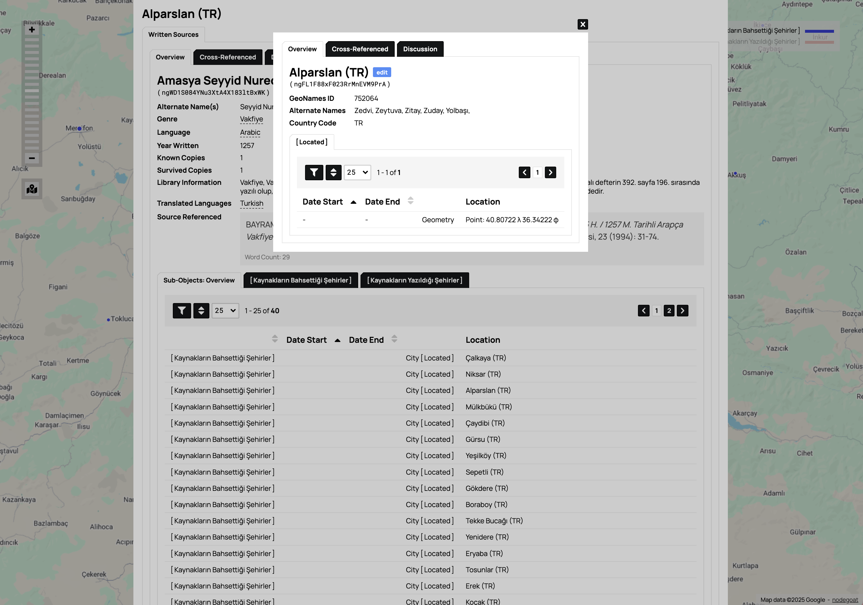
Database Interface for Alparslan — Detailed manuscript database with geographic location data and cross-referenced information
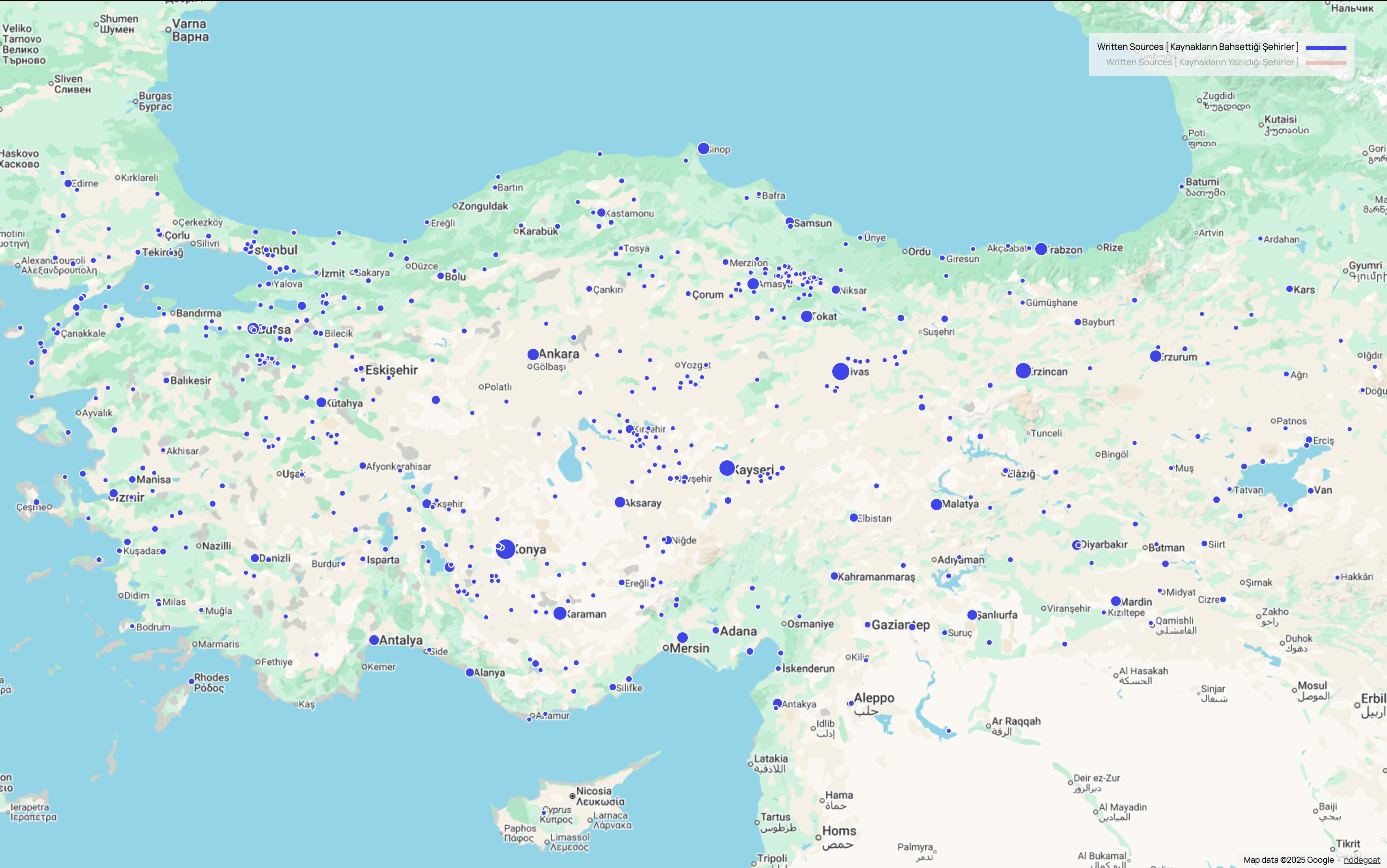
Turkey Overview Map — Geographic distribution of written sources across medieval Anatolian settlements
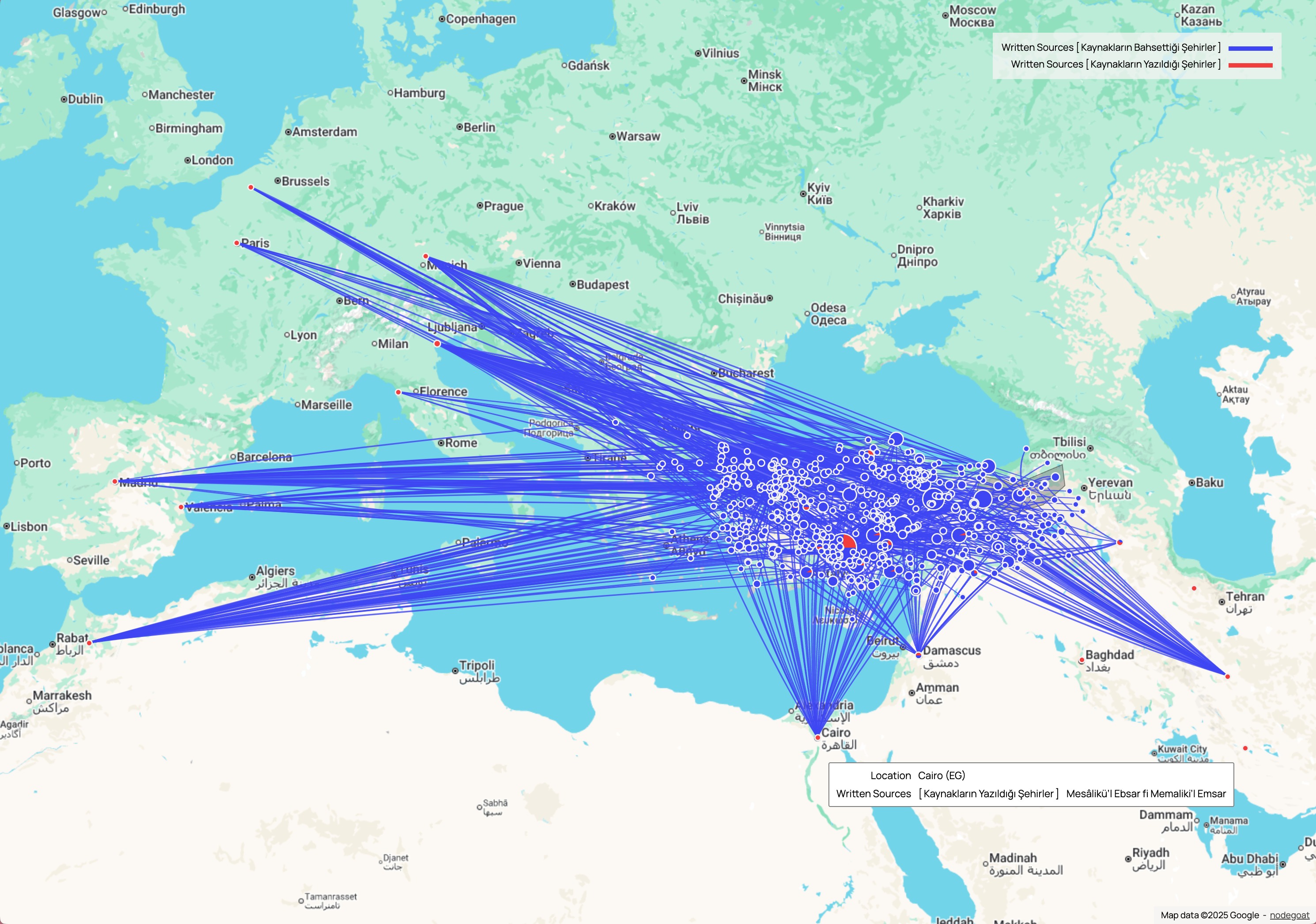
European Network Connections — Historical connections extending from Anatolia to European cities and regions
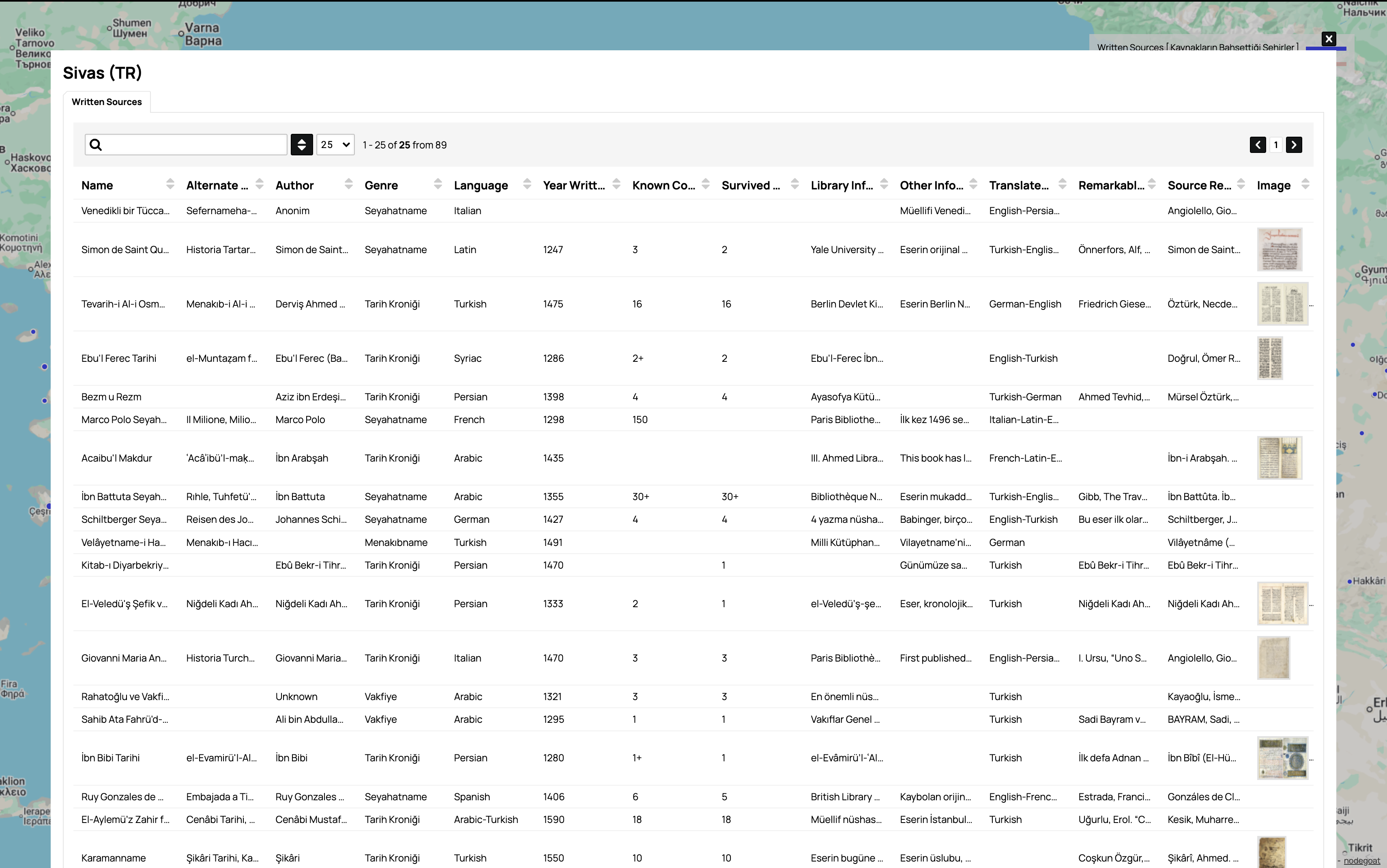
Sivas Data Table Interface — Comprehensive manuscript data table with detailed source information for Sivas region
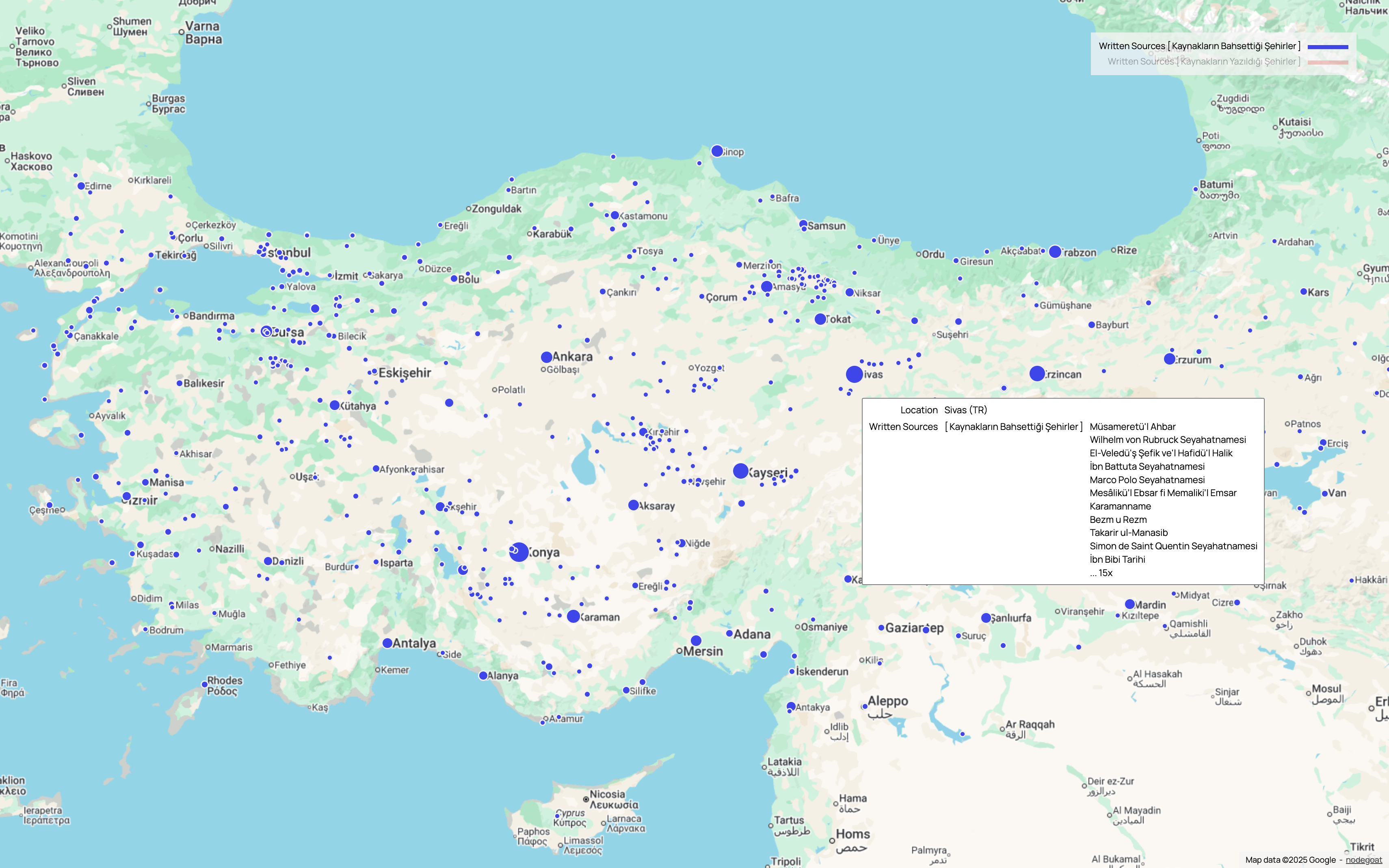
Sivas Location Details — Interactive popup showing written sources and manuscripts associated with Sivas location
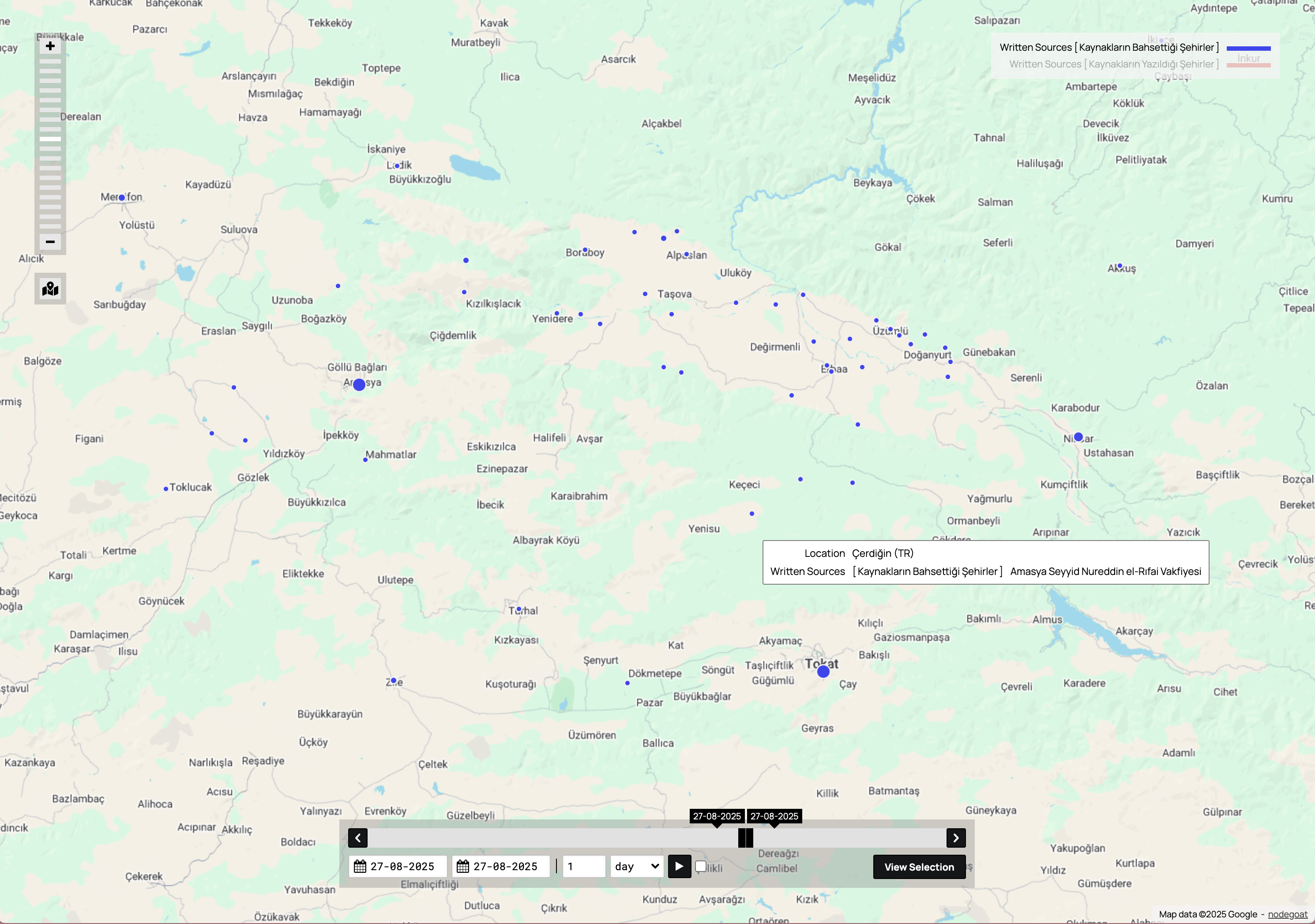
Çerdiğin Timeline Interface — Geographic interface with timeline controls for tracking historical changes over time
Toponymy Atlas
Comprehensive mapping of settlements from 1200-1450
Settlement Tracking
Villages and districts mapped with historical name changes
Interactive GIS
Advanced geographical information systems technology